Mapping and Modeling Shade in Urban Spaces
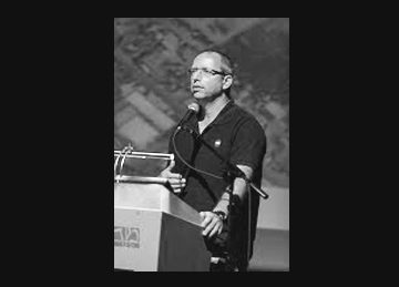
Dr. Arie Rosenfeld presented his talk on “Mapping and Modeling Shade in Urban Spaces Using GIS and Remote Sensing Techniques” at the “Urban Shade in […]
Read Moremapping in israel
Dr. Arie Rosenfeld presented his talk on “Mapping and Modeling Shade in Urban Spaces Using GIS and Remote Sensing Techniques” at the “Urban Shade in […]
Read More
Dr. Arie Rosenfeld presented examples of work carried out by Ecolo-GIS at the “FP7 “Space and GMES Initial Operations Symposium Opportunities and Networking 2011-2013”. The Symposium […]
Read More