The forestry projects presented here increased the efficiency of forest inventory surveys and forest monitoring for the “Israel Forestry Department”. List of projects:
- Estimating tree canopy cover at forest stands in Wadi Ara, Israel.
- Estimating tree canopy cover at forest stands in Jerusalem Mountains, Israel.
- Fire and Clear-cutting
- Mapping Dead and Dry Pine Trees in Yatir Forest, Israel. Conducted with Icaros Geosystems.
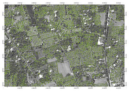
Mapping Dead Trees in Yatir Forest, Israel
Yatir forest is at the southern edge of northern hemisphere pine forests. It is composed mainly of planted Pinus halepensis and Pinus brutia trees. Yatir forest is also one of the largest planted forests in Israel.
Trees around the forest recently started to dehydrate and die. The dehydration is probably caused by global climate change – manifested as a decline in precipitation and an increase in temperature.
The Israeli Forestry Department is aware of the problem, and is searching for tools to map and monitor the trees, as the first phase in trying to deal with this problem.
Ecolo-GIS, together with Icaros Geosystems, mapped dead and dry trees in Yatir forest. The forest was photographed at a ground resolution of 27 cm, and image classification techniques were used to automatically delineate and map dead trees.